


Voting District 0416036, Nassau County, New York
About
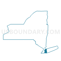
Outline

Summary
| Unique Area Identifier | 630507 |
| Name | Voting District 0416036 |
| County | Nassau County |
| State | New York |
| Area (square miles) | 16.25 |
| Land Area (square miles) | 2.58 |
| Water Area (square miles) | 13.67 |
| % of Land Area | 15.86 |
| % of Water Area | 84.14 |
| Latitude of the Internal Point | 40.86291270 |
| Longtitude of the Internal Point | -73.70569290 |
Maps


Graphs
Select a template below for downloading or customizing gragh for Voting District 0416036, Nassau County, New York


Neighbors
Neighoring Voting District (by Name) Neighboring Voting District on the Map
- Voting District 0113019, Nassau County, NY
- Voting District 0416001, Nassau County, NY
- Voting District 0416002, Nassau County, NY
- Voting District 0416003, Nassau County, NY
- Voting District 0416006, Nassau County, NY
- Voting District 0416011, Nassau County, NY
- Voting District 0416014, Nassau County, NY
- Voting District 0416015 0416016, Nassau County, NY
- Voting District 0416025, Nassau County, NY
- Voting District 0416035, Nassau County, NY
- Voting District 0416037, Nassau County, NY
- Voting District 0416039, Nassau County, NY
- Voting District 0416040, Nassau County, NY
- Voting District 0416042, Nassau County, NY
- Voting District 0416043, Nassau County, NY
- Voting District 0416044, Nassau County, NY
- Voting District 0416045, Nassau County, NY
- Voting District 0416046 0416053, Nassau County, NY
- Voting District 0416047, Nassau County, NY
- Voting District 0416056, Nassau County, NY
- Voting District 0416057, Nassau County, NY
- Voting District 0416065, Nassau County, NY
- Voting District 0513009, Nassau County, NY
- Voting District 070008, Westchester County, NY
- Voting District 070017, Westchester County, NY
- Voting District 070025, Westchester County, NY
- Voting District 110001, Westchester County, NY
- Voting District 190005, Westchester County, NY
- Voting District 2600014, Queens County, NY
- Voting District 2600067, Queens County, NY
- Voting District 2600068, Queens County, NY
- Voting District 8200005 8200041, Bronx County, NY
- Voting District 8200063, Bronx County, NY
- Voting District 8200107, Bronx County, NY
Top 10 Neighboring County Subdivision (by Population) Neighboring County Subdivision on the Map
- Queens borough, Queens County, NY (2,230,722)
- Bronx borough, Bronx County, NY (1,385,108)
- Oyster Bay town, Nassau County, NY (293,214)
- North Hempstead town, Nassau County, NY (226,322)
- New Rochelle city, Westchester County, NY (77,062)
- Mamaroneck town, Westchester County, NY (29,156)
- Glen Cove city, Nassau County, NY (26,964)
- Rye city, Westchester County, NY (15,720)
Top 10 Neighboring Place (by Population) Neighboring Place on the Map
- New York city, NY (8,175,133)
- New Rochelle city, NY (77,062)
- Glen Cove city, NY (26,964)
- Mamaroneck village, NY (18,929)
- Port Washington CDP, NY (15,846)
- Rye city, NY (15,720)
- Great Neck village, NY (9,989)
- Manhasset CDP, NY (8,080)
- Manorhaven village, NY (6,556)
- Kings Point village, NY (5,005)
Top 10 Neighboring Unified School District (by Population) Neighboring Unified School District on the Map
- New York City Department Of Education, NY (8,175,133)
- New Rochelle City School District, NY (77,062)
- Great Neck Union Free School District, NY (44,580)
- Port Washington Union Free School District, NY (31,071)
- Mamaroneck Union Free School District, NY (28,393)
- Glen Cove City School District, NY (26,964)
- North Shore Central School District, NY (16,334)
- Manhasset Union Free School District, NY (16,166)
- Rye City School District, NY (14,677)
Top 10 Neighboring State Legislative District Lower Chamber (by Population) Neighboring State Legislative District Lower Chamber on the Map
- Assembly District 16, NY (134,747)
- Assembly District 13, NY (131,694)
- Assembly District 91, NY (128,861)
- Assembly District 82, NY (125,736)
- Assembly District 26, NY (123,681)
Top 10 Neighboring State Legislative District Upper Chamber (by Population) Neighboring State Legislative District Upper Chamber on the Map
- State Senate District 37, NY (326,645)
- State Senate District 11, NY (320,102)
- State Senate District 5, NY (316,844)
- State Senate District 34, NY (315,408)
- State Senate District 7, NY (311,141)
Top 10 Neighboring 111th Congressional District (by Population) Neighboring 111th Congressional District on the Map
- Congressional District 18, NY (674,825)
- Congressional District 5, NY (670,130)
- Congressional District 7, NY (667,632)
- Congressional District 3, NY (645,508)
Top 10 Neighboring Census Tract (by Population) Neighboring Census Tract on the Map
- Census Tract 3011.01, Nassau County, NY (6,556)
- Census Tract 72, Westchester County, NY (6,514)
- Census Tract 76, Westchester County, NY (6,160)
- Census Tract 70, Westchester County, NY (6,087)
- Census Tract 3012, Nassau County, NY (5,889)
- Census Tract 71, Westchester County, NY (5,864)
- Census Tract 3005, Nassau County, NY (5,485)
- Census Tract 3004, Nassau County, NY (5,438)
- Census Tract 59.02, Westchester County, NY (5,340)
- Census Tract 3010, Nassau County, NY (5,332)
Top 10 Neighboring 5-Digit ZIP Code Tabulation Area (by Population) Neighboring 5-Digit ZIP Code Tabulation Area on the Map
- 11050, NY (30,171)
- 11030, NY (17,962)
- 11021, NY (17,729)
- 11023, NY (9,027)
- 11024, NY (8,002)
- 11363, NY (6,988)